Category:Downend, South Gloucestershire
Jump to navigation
Jump to search
English: Downend is a suburb of Bristol in South Gloucestershire, England. It is located to the North East of Bristol and bordered by the Bristol City suburb of Fishponds to its south west and the South Gloucestershire suburbs of Staple Hill to the south, Frenchay to the west and Emersons Green to the East. You can find the town on Google Earth with the coordinates N 51 29 16 W 2 30 15.
suburb in South Gloucestershire, England, UK | |||||
| Upload media | |||||
| Instance of | |||||
|---|---|---|---|---|---|
| Location | Downend and Bromley Heath, South Gloucestershire, Gloucestershire, South West England, England | ||||
 | |||||
Subcategories
This category has the following 3 subcategories, out of 3 total.
C
- Christ Church, Downend (12 F)
F
- Frenchay Bridge (7 F)
Media in category "Downend, South Gloucestershire"
The following 19 files are in this category, out of 19 total.
-
 2011 , A432 Badminton Road entering Downend - geograph.org.uk - 2550766.jpg 4,202 × 2,536; 3.32 MB
-
 2011 , A432 Badminton Road, Downend - geograph.org.uk - 2538294.jpg 3,970 × 2,023; 3.97 MB
-
 2011 , Badminton Road, Downend, Bristol - geograph.org.uk - 2550631.jpg 4,752 × 3,168; 6.48 MB
-
 2011 , Buckingham Place, Downend, Bristol - geograph.org.uk - 2550579.jpg 3,864 × 2,554; 4.28 MB
-
 2011 , Conversation in Buckingham Place, Downend - geograph.org.uk - 2550600.jpg 4,208 × 2,501; 3 MB
-
 2011 , Salisbury Road, Downend, Bristol - geograph.org.uk - 2550532.jpg 4,402 × 2,624; 4.1 MB
-
 2011 , Westbourne Road, Downend, Bristol - geograph.org.uk - 2550761.jpg 3,867 × 2,550; 3.52 MB
-
 Blackhorse Primary School.jpg 3,264 × 2,448; 2.19 MB
-
 Communications Mast, Supermarket, Downend. - panoramio.jpg 1,527 × 2,579; 658 KB
-
 Cricket in WG Grace's birthplace – Howzat! (2618841500).jpg 3,361 × 2,521; 1.29 MB
-
-
 Downend, Methodist church - geograph.org.uk - 2535081.jpg 1,024 × 768; 99 KB
-
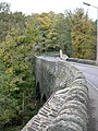 Downend, river bridge - geograph.org.uk - 2141057.jpg 768 × 1,024; 280 KB
-
 M4 near Downend, Bristol - geograph.org.uk - 2031108.jpg 3,036 × 2,010; 2.8 MB
-
 Memorial plaque, Downend Britannia air crash, Bristol, UK.jpg 2,649 × 1,589; 2.03 MB
-
 The former Vicarage, Downend (4787817654).jpg 1,944 × 1,296; 554 KB
-
 Westerleigh Road, Downend - geograph.org.uk - 362827.jpg 640 × 480; 84 KB
-
 WGGRACEMURALDOWNEND.jpg 1,092 × 1,578; 729 KB
-
 Frenchay Common - geograph.org.uk - 307949.jpg 640 × 480; 113 KB


.jpg)
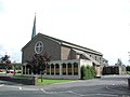
_St_Augustine_of_Canterbury_RC_Church_-_geograph.org.uk_-_67863.jpg)


.jpg)


